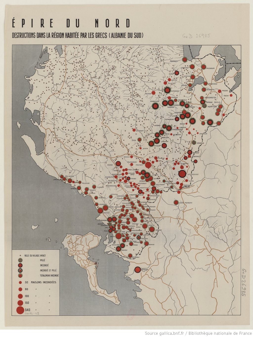
Map of disasters in Northern Epirus in 1913
This map, which is in the National Library of France, was published in 1913 and records the catastrophes in Northern Epirus. It is about the victims of war. Bottom left explains what the disks mean depending on the code they have. More specifically, it specifies whether it is an intact city or village, looted, burnt, burnt and looted, completely burnt, 30 burnt houses 60 burnt houses, 100 burnt houses 150 and 540 houses burnt burnt houses. This is how the targeting of the area can be clearly seen and if we link it to the fact that we are in the time when Albania must be born because of the will of Italy so that there is no expansion of Greece.
It is understandable the magnitude of the disasters and Sforza’s desire in 1919 for Albania to return to its 1913 borders. With this map we see the oppression that the Northern Epirots had undergone at that time in order the whole area integrated with this barbaric way into the newly established state.
source : Lygeros.org